
Detector Maps
GOLD DISCOVERY SOLUTIONS PTY LTD
4.1(8)NavigationAges 4+
Screenshots




About this app
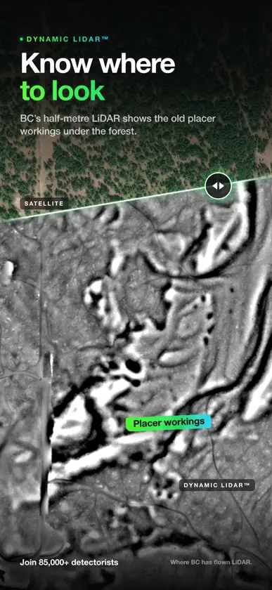
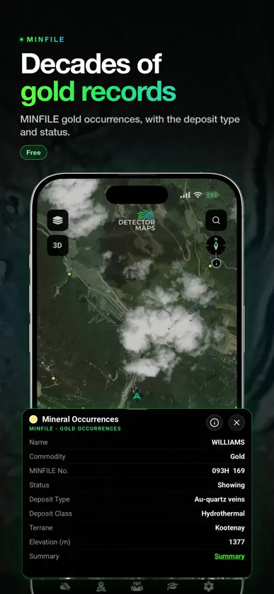
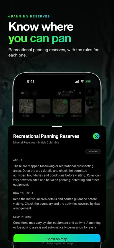
Detector Maps is the field tool that keeps you on the gold. Built by geologists for real prospectors and metal detectorists across Australia, the United States, New Zealand and Canada, it pairs advanced geological data with rock-solid GPS so you spend your time on high-potential ground, not guessing. Whether you are swinging a metal detector for gold, panning a creek or hiking into remote country, it puts serious geological intelligence in your pocket - and it works offline, where the gold actually is. Gold detecting is metal detecting, so the same tools help any detectorist work smarter. DATA LAYERS (where available) - Surface geochemistry with built-in filtering to target the right pathfinder elements - Historic gold mines and workings - detect where gold has already been found - Current and expired mining leases and claims, updated every weekday, so you know where you stand - 1-metre LiDAR hillshade that reveals old workings and ground features worth a closer swing - where available (a per-state add-on in Australia) FOR METAL DETECTORISTS The same tools that find gold help any detectorist. Use historic mines and old workings to find ground that produced before, read LiDAR to spot old sites and diggings the eye misses, and check leases, claims and boundaries before you ask permission. Then log every find, live-GPS your position and record your trail offline - the field kit every detectorist needs. BREADCRUMB TRAIL TRACKING (BACKGROUND GPS) Record your exact trail even when the app is in the background or the screen is off. See where you have walked, stop covering the same ground twice, and save paths for the next trip. WHY WE REQUEST "ALLOW ALL THE TIME" LOCATION ACCESS Detector Maps only uses background location when you switch breadcrumb tracking ON. This keeps an unbroken log of your journey while your phone is idle or the screen is off, and saves battery. Disable it anytime in the app or your device settings. WAYPOINT MARKING AND FIND LOGGING Drop waypoints on gold finds, targets, quartz outcrops, and old workings. Add names, notes and categories, then sync securely so your finds are never lost. REAL-TIME GPS NAVIGATION Track your live position and watch leases, boundaries, geology and terrain update around you as you move - a GPS built for gold prospecting and metal detecting. COVERAGE AUSTRALIA: all major gold states - QLD, NSW, VIC, WA, SA, TAS, NT UNITED STATES: California, Alabama, North Carolina, Arizona, Nevada, Idaho, Oregon, Utah, Colorado, Montana, Washington, South Carolina, Virginia, Georgia, New Mexico NEW ZEALAND: historic goldfields, geology layers and offline maps CANADA: British Columbia SUBSCRIPTION INFORMATION All plans include every map, the standard data layers, offline downloads, and access to Australia, USA, New Zealand, Canada (British Columbia) and the United Kingdom. USA Pricing - Explorer Monthly: $9.99 USD; Explorer Yearly: $99.99 USD. AUS/NZ/CA Pricing - Explorer Monthly: $9.99; Explorer Yearly: $99.99; Pro Monthly: $34.99; Pro Yearly: $249.99. Payment is charged to your Apple ID account at confirmation of purchase. Subscriptions automatically renew unless cancelled at least 24 hours before the end of the current period. You can manage or cancel your subscription at any time in your App Store account settings. Pricing may vary by region. PRIVACY AND DATA Your location, trails and waypoints are used only for core app functionality. Delete your account anytime: Profile > Delete Account > type "confirm" > tap the red Delete button. Privacy Policy: https://app.detectormaps.com/privacy-policy Terms of Use (EULA): https://app.detectormaps.com/license-agreement BUILT FOR REAL PROSPECTORS AND DETECTORISTS Whether you swing a GPX 6000, an SDC, a Gold Monster, another metal detector, a sluice or a pan, Detector Maps helps you cover more ground, log and revisit your best finds, and read gold-rich terrain with professional-grade geology. Start your next gold mission with confidence.
What's new
Version 6.1.0 · Nov 7, 2026
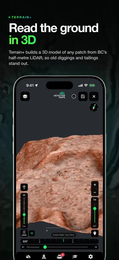
• BC gets Dynamic LiDAR and Terrain+ from BC's 0.5 m LiDAR. • Search finds gold occurrences by name, offline too. • Save a property as a permission from its boundary. NEW EVERYWHERE • Academy: short lessons on geology, LiDAR and detecting, written for your region. Each one shows you on a moving drawing, then lets you try it. • Your vault: log your finds with photos and see what they're worth. It locks with a PIN or Face ID. Open it from Settings. • Rain & Storms by Hour: a new Weather Forecast layer plays the next 7 days on the map. Drag its slider to pick a time, or tap the map for the forecast there. • Full screen map: the round button under 3D clears the controls off the map. Its navigation button adds a bearing bar, or locks the map on your position so it turns with you. • Location sharing: Invite by link. Anyone with the link can ask to join, and you still say yes or no to each person. • Saved areas now update themselves on Wi-Fi, and removing one gives the space back. See Settings > Storage. • Dynamic LiDAR: a new Copán colour for Local relief and Multi-scale. 1 m LiDAR draws sharper close up.
In-app purchases
The most popular purchases on the App Store.
- Yearly Plan Subscription · 7 days free trial$99.99 / year
- Monthly Pro PlanSubscription$34.99 / month
- Monthly Plan Subscription$9.99 / month
- Yearly Pro PlanSubscription · 7 days free trial$249.99 / year
You might also like
 RockHoundR: Rockhounding MapRuby Glint Technologies Co., Ltd
 LuckyFind: Metal Detecting AppStuck at Home, LLC
 Go TerrainXplorer
 3D Mappa - GIS & Topo ModelsAndres Narvaez
 Topo Maps USDC Cloud Apps, LLC
 Australian Geology Travel MapsDavid Collins
 planlauf/TERRAINplanlauf GmbH
 DiglyMETTE HAUGEN
 ExploreHere - Roadtrip GuideWesley Vance
 TopoRec - Map ViewerEnrico Hoffmann