
TAB Maps
Tayfun Dincer
No ratings yetProductivityAges 4+
Screenshots





About this app
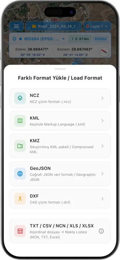
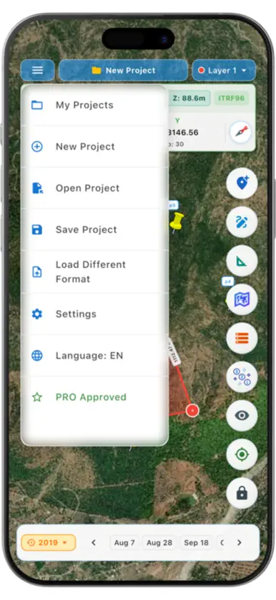
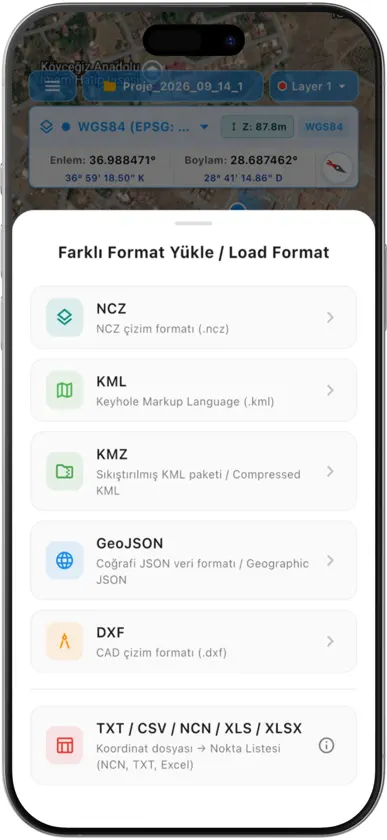
TAB Maps is an all-in-one GIS and mapping application designed for surveying engineers, cadastral specialists, civil engineers, architects, real estate appraisers, farmers, and anyone performing professional measurements in the field. View, edit, measure, and generate professional reports from your NCZ, KML, KMZ, and DXF (CAD) files directly on your mobile device with high speed and precision. KEY FEATURES: KML, KMZ, AND CAD (DXF) SUPPORT - Open KML, KMZ, and DXF files with a single tap and display them as layered maps. - Review your drawings, land parcels, and road alignments right on your mobile device. - Export created or edited projects in KML, KMZ, and DXF formats. ADVANCED MEASUREMENT AND DRAWING TOOLS - Area and Parcel Measurement: Instantly calculate the area (m², acres, hectares) and perimeter of parcels, fields, or polygons. - Distance and Route Measurement: Measure true ground distances between two or more points. - Point Management: Pin any point on the map, label it, and store elevation (z-value) data along with custom notes. INTERNATIONAL AND LOCAL COORDINATE SYSTEMS - WGS84 Geographic Coordinates (Degrees Minutes Seconds - DMS & Decimal Degrees). - UTM Projections (3-degree and 6-degree zones). - Turkey Coordinate Systems: ITRF96 (3° & 6° TM) and ED50 (3° & 6° TM) with automatic Central Meridian (DOM) and Zone calculations. - 8,000+ Worldwide EPSG Projections: NAD83 (North America), OSGB36 (UK), CH1903+ (Switzerland), RGF93 / Lambert-93 (France), RD New (Netherlands), ETRS89, and many more. - Automatic local EPSG projection detection and coordinate transformation based on your current location. STAKEOUT AND TARGET NAVIGATION - Looking for a boundary marker or property corner in the field? - Select your target point, and let the app guide you with a live dynamic compass and real-time distance line with high precision. RICH MAP LAYERS AND 3D VIEW - Seamlessly switch between high-resolution satellite imagery, terrain (topographic), and street maps. - Utilize the 3D map view to better visualize slope and terrain morphology. PROFESSIONAL PDF AND COORDINATE REPORTS - Export all collected field points, measurement results, and coordinate summaries into professional branded PDF reports. - Instantly share reports with colleagues via WhatsApp, Email, or cloud storage services. WHO IS IT FOR? - Surveying & Cadastral Engineers and Technicians - Civil Engineers and Site Construction Teams - Architects and Urban Planners - Real Estate Appraisers and Property Consultants - Agriculture, Forestry, and Land Management Professionals - Outdoor Enthusiasts and Field Navigators Simplify your measurements and boost your field productivity with TAB Maps—your trusted digital field assistant! ---------------------------------------- About Subscriptions: - TAB Maps Pro subscription is available on a monthly or yearly basis. - Payment will be charged to your iTunes/Apple account upon confirmation of purchase. - Subscriptions automatically renew unless auto-renew is turned off at least 24 hours before the end of the current period. - You can manage or cancel your subscriptions and turn off auto-renewal at any time in your App Store Account Settings. ---------------------------------------- Terms of Use (EULA): https://www.apple.com/legal/internet-services/itunes/dev/stdeula/ Privacy Policy: https://tabgis.com/tab-kml/privacy-policy Support: https://tabgis.com/contact
What's new
Version 2.0.4+26 · Oct 8, 2026
• Improved NCZ/DXF and KML/KMZ processing and map rendering performance. • Enhanced stability and responsiveness in drawing and measuring tools. • UI adjustments for a smoother user experience. • Bug fixes and general performance optimizations.
In-app purchases
The most popular purchases on the App Store.
- TAB Kml/Kmz-GPRS / GIS SurveyConsumable$54.99
- Aylık PremiumSubscription · 3 days free trial$2.99 / month
- Yıllık PremiumSubscription · 3 days free trial$30.99 / year
More from Tayfun Dincer

You might also like
 CadXiaMehmet UYANIK
 MobilCAD: CAD Drawing & MapsIsmet Koc
 Kablo Hesaplama ElektrikSeyfettin Aslan
 Mapit GISAndrzej Bieniek
 FO Maps: GeoPDF GPS Offlinejuan carlo abuin pampaloni
 Prime Merchant.RAKSU CO. LTD.
 MCBackup: My Contacts BackupRavi Kotadiya
 SW MapsAviyaan Tech
 Lifebox: Storage & BackupLifecell Cloud
 Electrical CalculationsEgal Net di Ettore Gallina