
gpMapper
FTI (1997) Pty Ltd
No ratings yetBusinessAges 4+
Screenshots




About this app
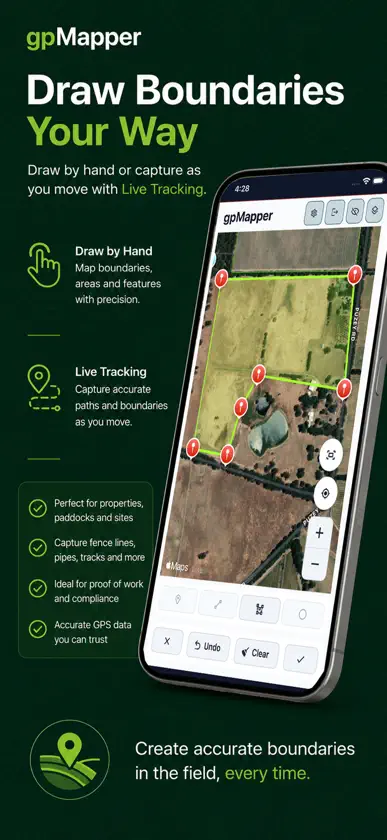
Professional Mapping. Simple to Use. gpMapper is a powerful GPS mapping application designed for professionals who need to create, manage and share accurate maps wherever work takes them. Whether you're mapping farms, construction sites, parks, utilities, environmental assets, infrastructure or commercial properties, gpMapper provides an intuitive mobile experience that works seamlessly with the gpMapper Desktop application. Create detailed maps in the field, capture accurate measurements and organise your projects using unlimited layers and map views. Once you're back in the office, simply synchronise your work with gpMapper Desktop to continue editing, analysing and reporting. Key Features • Map properties, sites and assets with ease • Draw boundaries manually or capture them using live GPS tracking • Measure areas, distances and circles with precision • Record and manage assets directly on your maps • Organise projects with unlimited layers, layer groups and map views • Share and export mapping data • Synchronise instantly with the gpMapper Desktop application • Fast, intuitive interface designed for professional field work Built for Professionals gpMapper is suitable for a wide range of industries, including: • Agriculture • Construction • Civil Engineering • Local Government • Utilities • Environmental Management • Mining • Property Management • Land Development • Surveying and Consulting Whether you're mapping a single property or managing thousands of assets across multiple projects, gpMapper scales to suit organisations of every size. Accurate Mapping Wherever You Work Capture boundaries, map infrastructure, locate assets and build detailed spatial information using the GPS capabilities of your mobile device. gpMapper makes it easy to collect reliable field data that integrates directly with your desktop workflow. Continuous GPS Tracking Never lose your mapping session. When recording live boundaries, lines or equipment paths, gpMapper can continue capturing GPS positions if you temporarily switch to another app or answer a phone call. This ensures your mapping remains complete and accurate, without gaps in the recorded data. Ideal for: Live boundary mapping Weed and pest mapping Fence, power line and pipeline mapping Vehicle and machinery tracking Proof of work and product placement Compliance and reporting Seamless Desktop Integration Unlike standalone mapping apps, gpMapper is designed to work hand-in-hand with the gpMapper Desktop application. Your field data can be synchronised quickly, allowing office and field teams to work from the same up-to-date information. Spend less time transferring data and more time making informed decisions.


