
Satvis
Florian Mauracher
No ratings yetUtilitiesAges 4+
Screenshots




About this app
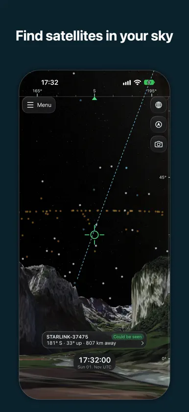
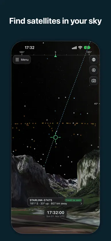
Satvis is a free, open-source satellite tracker for iPhone and iPad. It draws more than 16,000 satellites on a 3D globe in real time: Starlink, GPS, weather satellites, the ISS and many more. Set your location and it predicts when each one passes overhead. The sky view shows the sky from where you stand. Point your phone up to see the satellites in that direction. WHAT IT DOES • Visualize satellites on a 3D globe in real time, propagated on the device with SGP4 from CelesTrak's element sets • Show points, labels, orbits, orbit tracks, ground tracks, sensor cones, 3D models and ground station links per satellite, colored by orbit class (LEO, MEO, GEO, HEO) • Switch catalog groups on and off (Starlink, GNSS, weather, Earth observation, crewed stations), or search for a single satellite • Select a satellite to see its orbit, its next passes over your locations and its spacecraft details: country, operator, manufacturer, bus, mass and size • Track a satellite: the camera flies to it and follows it along its orbit • Save your location or any point you pick on the map, then list the upcoming passes over it and get a notification before one starts • Find satellites overhead in the ground-level sky view, aimed by dragging or by pointing your phone, with the camera's picture of the sky behind them • See which satellites you could spot: the sky view dims those in Earth's shadow, too far away or in a daylit sky • View the globe in 3D or flattened to 2D, over the base map, star field and terrain you choose: satellite imagery, Earth at night or the day's VIIRS imagery • Start from the featured views, bookmark your own, and share any view as a link: it opens the same view on satvis.space • Open satvis.space links straight in the app • Keep using it offline, from the satellite data it last fetched WHERE THE DATA COMES FROM Element sets come from CelesTrak, refreshed several times a day, and are propagated on your device with SGP4. Spacecraft details come from Jonathan McDowell's GCAT. FREE AND OPEN SOURCE No account, no ads, no in-app purchases. Developed in the open at github.com/Flowm/satvis under the MIT license.
What's new
Version 2.1 · Nov 6, 2026
NEW • iPhone Duo support • Camera passthrough in sky view • Satellite positions on a 2D map • 3D spacecraft models in the satellite info panel • More Graphics settings, including frame rate and a higher-detail star map IMPROVED • Design: a refreshed look, a better iPad layout, better support for large text, and numbers and dates in the device's regional format. • Performance: the globe redraws only when something on screen moves, reducing battery consumption. Satellite data and 3D models load faster and use less memory, panning stays smooth with thousands of satellites, and iPhones can run at 120 fps. • Sky view: look up from any saved location or, through a long-press menu, from any spot on the globe. The satellite in the crosshair gets a more compact card, and terrain turns on automatically, so hills and mountains show on the horizon. • Web app alignment: panels, settings and the sky view card work as they do on the web, and tracking a satellite shows it from the same camera angle. • Reliability: better recovery from loading errors, and many smaller fixes.
More from Florian Mauracher

You might also like
 Sun TimeZoneArshdeep Singh
 WANJIN ESSAnhui Udan Technology Co., Ltd.
 Let-Plan-ItSareuon Sum
 AimSatZACHARY AARON CALDWELL
 Cris GPShernando oviedo
 ConstructionCalcPro24ALPIAAL SERVICES LTD
 Seen from Space: Satellite MapTigran Barseghyan
 Mimet NFC ToolMimet
 Clocks in MotionStefano Acerbetti
 iDibujo: Sketch & PaintIsrael Manzo