
PilotFlight: Flight Planner
Yigit Can Akinci
No ratings yetNavigationAges 4+
Screenshots







About this app
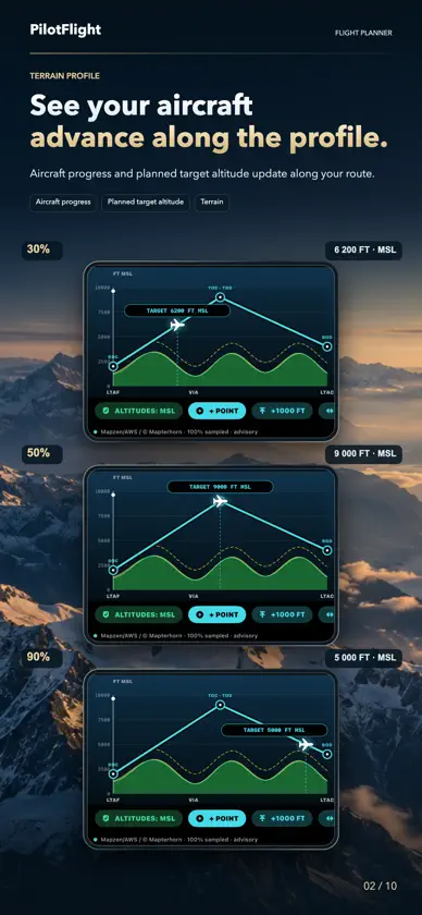
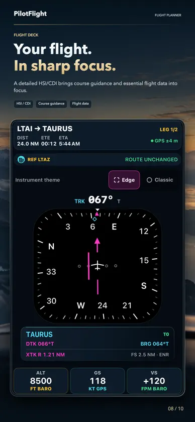
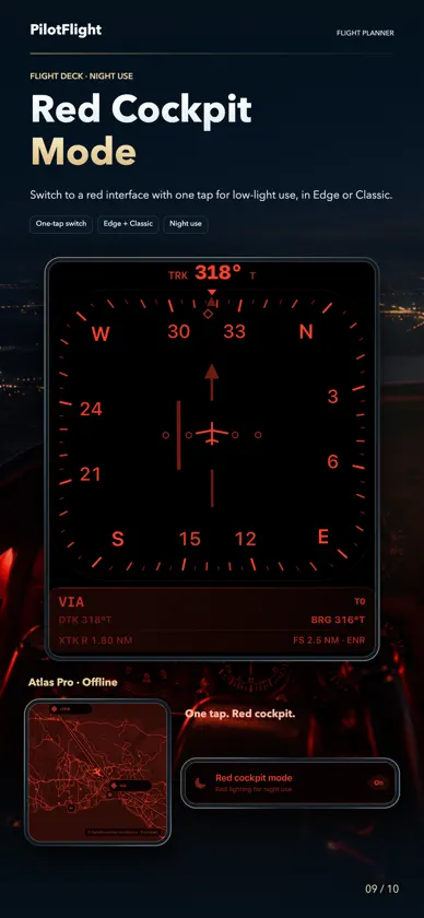
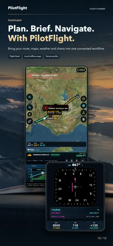
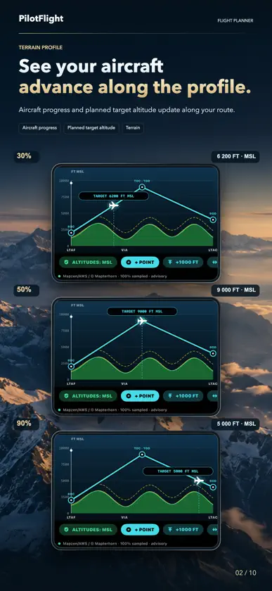
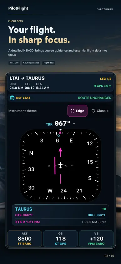
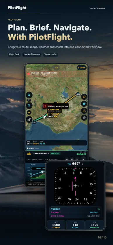
Plan, brief, navigate and review your flights in one focused workspace on iPhone and iPad. PLAN EVERY STAGE • Build routes with ICAO airports, saved waypoints or coordinates. Add, drag, reorder or delete intermediate points; review distance, ETE and altitude. • Planning Desk builds a wind-corrected pilot log, sector assumptions and fuel policy from pilot-entered data, with text and printable-PDF export. • Weight & Balance checks pilot-entered aircraft loading against a CG envelope; verify all limits against approved documents. • Flight Kit stores your PDFs and aircraft checklists locally, previews GPX route imports and exports routes/tracks as GPX or the logbook as CSV. The app supplies no certified documents or checklists. • Airfields & Radio combines route/nearby airports, runways and available TWR/APP/COM frequencies. • Airspace & Profile shows imported boundaries, route crossings and comparable MSL bands. • Procedures & Charts manages source-dependent SID, STAR, approaches, holds, runway guidance, navaids, reporting points, information, frequencies and regional NOTAMs. LIVE MAP, TERRAIN AND FLIGHT DECK • See ownship, planned route, Direct-To/live guidance and breadcrumb track on satellite, hybrid or terrain backgrounds, with optional 3D relief. • Map Tools controls available airspace, worldwide SIGMET, PIREP, source-dependent NOTAM, procedure, navigation, information and frequency layers. • View sampled terrain beneath the active route, compare it with planned MSL altitude and a chosen vertical margin, and shape altitude by leg or with movable points. Results appear only where samples are available. • Use the refined HSI/CDI navigation display with BRG, DTK and XTK, plus GPS altitude, groundspeed, vertical speed, ETE and ETA when supported sensor data is available. BRIEF, FLY AND REVIEW Read exact-station METAR/TAF when available; assess runway wind, personal minimums and hazard context. Record or recover a flight, replay tracks or rehearse routes in Flight Review, export GPX and keep notes and a local logbook. READY BEYOND THE SIGNAL Download worldwide offline basemaps and change the background inside Live Map while retaining the active route and guidance. Imported or previously refreshed layers use only the last verified data held on the device. Ten editable tools—including wind triangle, density altitude, fuel/endurance, top of descent, glide and turn performance—work locally. DATA AVAILABILITY Weather and worldwide SIGMET use official AviationWeather.gov/Aviation Weather Center services. NOTAM display is not a complete briefing: FAA supplies a U.S. graphical TFR subset; other NOTAM, procedure, information, frequency and airspace layers depend on installed, imported or configured sources. Coverage and currency vary. An empty layer never means all clear. PAID ACCESS All features require auto-renewable PilotFlight Pro; no free tier. Choose monthly or yearly. Eligible new subscribers receive one month free. Unless canceled at least 24 hours before the trial or period ends, the plan starts or renews at Apple’s displayed local price. Manage in Apple Account settings. IMPORTANT PilotFlight is a supplemental planning and situational-awareness aid, not a certified primary flight/navigation instrument or a substitute for approved charts, AIP data, official weather/NOTAM briefings, ATC instructions, aircraft documentation or pilot judgment. Flight Deck does not provide a certified attitude reference or indicated airspeed. Always verify current approved sources before flight. 25 interface languages. Offline Tutorial: English narration and subtitles in 25 languages. Send routes to the optional, separately available PilotFlight Apple Watch app. Terms of Use (Apple Standard EULA): https://www.apple.com/legal/internet-services/itunes/dev/stdeula/ Privacy Policy: https://akincijet.com/pilotflight-ipad-privacy.php?lang=en
What's new
Version 1.4.1 · Nov 6, 2026
Improved saved-waypoint route navigation and map/terrain stability. Automatic leg transition distance can be adjusted and is retained when reopening the route planner or app. Fixed reopening the lower TRK/DTK/XTK panel even without an active route.
In-app purchases
The most popular purchases on the App Store.
- Yearly AccessSubscription · month free trial$74.00 / year
- Monthly AccessSubscription · month free trial$7.00 / month
More from Yigit Can Akinci


You might also like
 PilotDeckFlight Service SIA
 FlightPlan ProAhmed Mamdouh
 E6B Flight Computer CalcGrima Hdez
 Ascent EFBGeoSpatios
 GeoChartsSkyler Cuthbertson
 Flight Kneeboard EFBYINGZHI TANG
 De Plane! Overhead AlertsAssorted Logic
 Flight Radar: Sky ScannerSergey Gorelov
 FlyCharts - Sim Flight PlannerAppeed
 iEFIS ProairWORK aviation media UG