
ArkenMap
ALEXANDER THOMAS ROBINSON
5.0(3)NavigationAges 4+
Screenshots


About this app
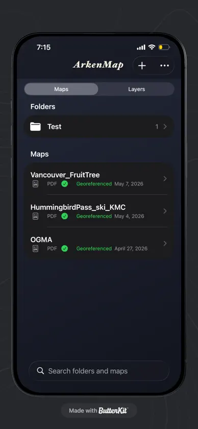
ArkenMap turns georeferenced PDF maps into something you can use outside: open the sheet full screen and see where you are on the map when you allow location access. What you can do Import PDF maps from Files or share sheets and keep them in a simple library on your device. Pan and zoom the PDF with familiar gestures. Show your position on the map when Location is enabled (while you’re using the app). Works with PDFs that include georeference / measure information (for example GeoPDF-style GPTS/LPTS metadata). Designed for real maps ArkenMap is built for georeferenced PDFs—trail maps, forestry or resource maps, planning PDFs, and other cartography exported with embedded coordinates. Privacy-minded Imported PDFs and your library are stored locally on your iPhone or iPad. The app is focused on on-device viewing and positioning, not on uploading your maps to our servers. Notes: Accuracy depends on your PDF georeferencing, device GPS, and coordinate system handling in the app. Some datum and projection differences can cause small shifts compared to survey-grade tools.
What's new
Version 2.22 · Jul 30, 2026
Small bug fix to ignore multiple map coordinates in a single PDF Map.
In-app purchases
The most popular purchases on the App Store.
- Unlimited PDF MapsConsumable$3.99
More from ALEXANDER THOMAS ROBINSON


You might also like
 Falk MapsMAIRDUMONT
 Outmap: Ski & Snowboard MapsTechnologies Outmap Inc.
 Live Street View - MapsBUSINESS SOLUTIONS INTERNATIONAL (PRIVATE) LIMITED
 Topo Maps+: Topographic MapsGlacier Peak Studios LLC
 UTM Geo Map Y2TechYogi Yogantara
 Scratch Atlas: Travel MapMarta Lopez Olias
 CoMapsAnton Wenemoser
 BRMB Maps by Backroad MapsMussio Ventures Ltd.
 Organic Maps・Offline Maps, GPSOrganic Maps
 3D Offline Maps: GPS trackerSERGEI BEZDENEZHNYKH