
Spatial Continuum
AO2 IT LLC
5.0(2)UtilitiesAges 12+
Screenshots




About this app
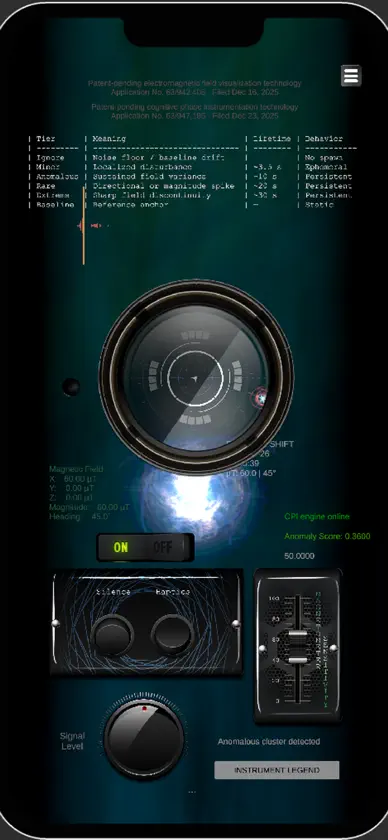
Spatial Continuum™ is a differential magnetometer visualization and directional-awareness system that transforms live electromagnetic field data into persistent, spatially positioned orb markers — encoding magnitude, direction, rate of change, and event persistence into a readable field narrative that a conventional spike graph cannot provide. A baseline reference state is established at the beginning of each session. Every subsequent event is measured as a deviation from that anchor, with lateral axes amplified for spatial expressiveness and the vertical axis damped to reduce noise caused by normal device handling. Each generated orb carries its own event information, including timestamp, directional heading, magnitude, and tier classification — Minor, Anomalous, Rare, and Extreme — with classifications governing on-screen persistence from approximately 3.5 to 30 seconds. The CPI Engine produces a continuous anomaly score between 0.0 and 1.0. Higher-scoring events generate increasingly persistent visual markers, allowing investigators to identify significant field changes and observe where activity developed, how rapidly it changed, and how long it remained present. This is not visualization for atmosphere. It is a differential field-awareness instrument built to turn changing magnetometer data into a persistent spatial record. The field has direction. Now you can see it. Not made for entertainment. Patent-pending EMF and cognitive phase instrumentation — USPTO Provisional #63/942,408 & #63/947,185. --- BONUS INSTRUMENTS — INCLUDED FREE EMF Entropy™ A physics-driven electromagnetic visualization instrument that applies real-time entropy mapping to live magnetometer data. EMF Entropy™ analyzes changing magnetic-field behavior and generates a continuously evolving waveform rather than displaying a prerecorded or randomly animated signal. A 7.83Hz Schumann Resonance reference is incorporated into the visualization system to give investigators an additional comparative reference during field sessions. Coherent, turbulent, and fragmented waveform behavior can be observed as environmental magnetic conditions change. On Site Metrics™ A location-aware environmental and astronomical intelligence panel providing investigation context including temperature, cloud cover, UV index, solar radiation, irradiance, sunrise and sunset, moonrise and moonset, moon phase, and lunar illumination percentage. Location is used for local environmental data requests and astronomical calculations. Investigation data is not transmitted. Both bonus instruments are included at no additional cost. This is instrumentation. This is research. This is Ghost Hunter Apps.
More from AO2 IT LLC


You might also like
All apps like Spatial Continuum → GhosthoundFieldMATTHEW DAVID FABIAN
 FireBug Night VisionMichael Weber
 TeslaVision EMF DetectorMichael Weber
 VseeBox USA Store Tech SupportGiuseppe Giannetto
 Transcend Theorychris rogers
 Oblivion Companion & GuideFelipe Braunger Valio Desenvolvimento de Sistemas Ltda
 Spatial Phone : MirrorGulzar Ahmed
 Companion & Guide for SFFelipe Braunger Valio Desenvolvimento de Sistemas Ltda
 Necrometerchris rogers
 Elden Ring MapFelipe Braunger Valio Desenvolvimento de Sistemas Ltda